Recreation
THE ANDROSCOGGIN RIVER
boating, fishing, picnicking
Due to its 1000-foot drop from headwaters to the sea, the Androscoggin boasts an average descent of 8 feet per mile, making it a swift-flowing, high-volume river and an excellent power source. This geographical feature spurred the region into becoming an industrial hub during the Industrial Revolution. While the Androscoggin powered numerous mills and factories, it also bore the environmental impacts of industrialization, much like many other communities across America. As industry declined, it strained the local economy and opened up new recreational opportunities. Once labeled one of the ten most polluted rivers in the nation, the Androscoggin River has made an incredible recovery.

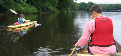
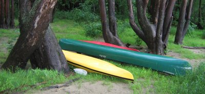
Today, the Androscoggin River is dotted with numerous boat put-ins along its entire length, and sightings of bald eagles have become commonplace in the area, signaling a thriving ecosystem. Recreation on the river is flourishing, and a canoe ride on any stretch reveals a world of beauty and tranquility.
During your journey, you might witness the majestic sight of an eagle engaging in aerial pursuit with an osprey or catch a glimpse of a kingfisher with a fish in its mouth perched on an overhanging branch, later darting off with its distinctive "rat-tat-tat" call. A green heron may be spotted under an overhanging bank, motionless as it watches your passage with wary eyes. In calm stretches, great blue herons may be seen, statuesque as they patiently stalk fish fry in the shallows.
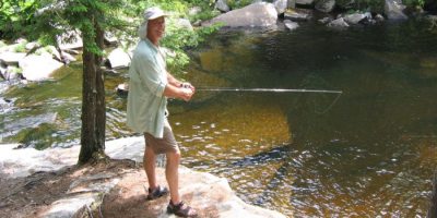
Fishing enthusiasts will find ample opportunities along the Androscoggin, which boasts some of the best bass fishing in the northeast. For those seeking a challenge, wily brown trout can be found lurking in the riffles, providing a thrilling pursuit for fly fishermen. From children casting lines with worms below Riley Dam to fly fishing classes conducted by LL Bean near Pine Island, the river offers something for anglers of all ages and skill levels.
If you find yourself in the area during mid-summer, don't miss the opportunity to join an annual tradition: The Source to Sea Canoe Trek, organized by the Androscoggin Watershed Council. Every July, the Council orchestrates this scenic journey, from the river's origin in New Hampshire to its culmination in Merrymeeting Bay. The trek typically passes through our region in late July, offering manageable segments of approximately ten miles of mostly flat-water paddling.
Participation in the trek is hassle-free as the Council provides all necessary equipment; reserve your spot and show up! It's a fantastic way to immerse yourself in the river's beauty, and best of all, it's free! For schedule details, visithttp://www.avcnet.org/arwc/trek.html.
With its natural splendor, the Androscoggin River is an undiscovered gem waiting to be explored. Don't miss your chance to experience its wonders firsthand!
Canoeing the Androscoggin
Dixfield River Access—Pine Island/Snoopy River Access: This section of the river is less frequented by paddlers. It offers a serene journey through corn and potato fields flanked by hardwood-lined banks. One portage is required around Riley Dam. Note that there are no public access points upstream of the Livermore Falls Dam after the Pine Island River access point. Paddlers wishing to continue downstream must transport their boats past the Livermore Falls Dam.

Livermore Falls - Twin Bridges Flatwater - Class 2+: Silver maples and other hardwoods characterize this stretch of the river, providing a tranquil setting devoid of nearby roads or bridges. Two sets of rapids midway down offer a moderate challenge, requiring adept boat control. Caution is advised: downstream of the Twin Bridges, there is a significant ledge drop rapid on the river right. Paddlers should disembark on the island and portage around the rapids. The channel along the river left may be navigable at certain water levels.
Local access points include:
-
Riley Dam River Access/Portage: This access point is located on the north/east side (river left) along Rt. 140, near the Jay/Canton town line. It provides both upstream and downstream access.
-
Mill/Pine Island River Access/Portage: Found on Route 4, follow signs for the Mill and cross the river on the POW Remembrance Bridge (Riley Rd.). Turn right for upstream access; the access point will be on the right. Pine Island serves as a picnic area and boat access, which is more suitable for downstream access. Note that there is no public access downstream from Pine Island.
-
Livermore Falls Dam River Access: The river is accessible on the west side (Livermore side), south of the Rt. 4 bridge on River Rd. Anglers and kayakers can utilize the signed access point on the Livermore side, while the Foundry put-in is located on Foundry Road. To reach Foundry Road, take a right immediately after crossing the Rt. 4 bridge northbound, proceed through the parking lot behind the town offices, and turn left onto Foundry Road, traveling approximately 0.3 miles.
Fishing

The Androscoggin River in this area is renowned for offering some of the finest smallmouth bass fishing in the northeastern United States. Additionally, anglers can find opportunities to catch brown trout, brook trout, and rainbow trout in these waters.
Bartlett Pond, Livermore (fishing)
26 acres, max depth 26 ft
Get Map
Brook trout and rainbow smelt. There is a heavy annual stocking of Brook Trout in the reclaimed pond. There is no formal boat put-in or parking.
Round Pond, Livermore
(fishing, boating, swimming, picnicking)
Get Map
166 acres, max depth 32 ft
Brown Trout, Smallmouth Bass, Pickerel, White Perch
Annually stocked with Brook and Brown trout, Round Pond offers ample off-the-road parking in a beautiful wooded parcel called "The Pines."
Long Pond, Livermore (fishing, boating, swimming, and picnicking)
203 acres, max depth 18 ft
Get Map
Annually stocked with book and brown trout. The parking at Long Pond is close to the road, so be extra careful when loading and unloading.
Brettuns Pond (fishing, boating, swimming, and picnicking)
154 acres max depth 52 feet
Get Map
Smallmouth Bass, Brown Trout, White Perch. Annual stocking with brook and brown trout. Nice boat put in and picnic area in a pine grove
Moose Hill Pond, Livermore Falls (fishing)
96 acres, max Depth 42 feet
Get Map
Smallmouth Bass, Chain Pickerel, Yellow Perch, Sunfish
The water source for Livermore Falls has no motorized boats or swimming. Please cooperate with the Livermore Falls Water District.
Parker Pond, Jay (fishing, boating)
102 acres, max depth 26 feet
Get Map
Smallmouth Bass, White Perch, Chain Pickerel, Sunfish
Seven Mile Stream in Jay
Take Route 4 in North Jay and Route 17 across from the fire station. A mile or so up on the left-hand side, just after a right-hand curve in the road, in Morse Hill Road. Turn left, and you will see the bridge over Seven Mile Stream.
Fruit Picking
Boothby's Orchards
366 Boothby Rd, Livermore
Berry Fruit Farm
54 Main Street, and Crash Road in Livermore Falls.
Rupert’s Strawberry Farm
514 Wilson Rd Turner
Kents Hill Orchard
1625 Main Street Readfield
Stevenson’s Strawberry Farm
271 Tucker Rd Wayne
Steep Hill Farm
26 Clyde Wells Rd, Fayette
Golf Courses

Turner Highlands
10 Highland Ave Turner
(207) 224-7060
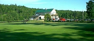
Eighteen holes
Wilson Lake Country Club
320Weld Road Wilton
(207) 645-2016
Nine holes.
Springbrook Golf Club
141 Route 202 Leeds
(207) 946-5900
Eighteen holes
Hiking
Jay Rec Trails
A series of trails are behind the North Campus of Spruce Mountain High School (formerly Jay High School campus). Click here for the map.
Pine Island Park
Pine Island Park is a lovely park in the middle of the Androscoggin River. It has a picnic area, ample parking, and short side trails leading to picturesque outlooks on the river. There is also a public boat put-in. The park is owned and maintained by International Paper Company and available for public use. Access is off Riley Road.
HOURS: Dawn to dusk
French Falls River Walk
Created by Jay High School Adult Education in 1996. It features two short loops of .5 and .75 miles, respectively. The trails wind down behind the recreation fields and provide lovely views along the river.
Parks and Recreation
French Falls
At French Falls, there are picnic tables, a basketball hoop, ball fields, and walking paths, and in the winter, the fields are flooded to provide skating.
Jay Parks and Recreation contact the town office at 207-897-6785.
Livermore Falls Recreation Department 207-897-2016
North Jay White Granite Park
The park has picnic tables, benches, and a great one-mile trail that meanders through the orchard. A small outlet trail from the orchard brings you to a small quarry that is still being worked on today. Large pieces of granite and paving stones are scattered throughout the site.
Sightseeing/Road Trips
Route 17
Livermore Falls to Readfield and Augusta, travel east on Route 17, scenic lake views, picturesque family cemeteries, shaded country road, historic houses in Readfield and Kents Hill, and great views when approaching Kents Hill School.
-
Route 108 and 117
From North Livermore to Route 4 in Turner, take a close-up look at quaint New England houses, hillside apple orchards, beautiful old farms, and cultivated fields. View from high above the valley. Take a small detour in Livermore onto Norlands Road and Norlands Living History Center. Soules Hill, East Jay (Chesterville line).Take Route 4 across from Franklin Memorial Hospital in Farmington to Rt. 156 (or you can come up Rt. 133 from Livermore Falls). Take a left and the next right onto the Soules Hill Rd. At the top, you will see a grand view during every season. In summer and spring, see wondrous shades of green. Electric colors, including rich reds, deep amber, pumpkin orange, and royal purple, can be seen in September and October. The Franklin Heritage Loop includes over 100 sites in Farmington, Rangeley Lakes Region, and Sugarloaf. Visitors and residents are welcome to explore the natural and historic features. Hiking, Canoeing, hunting and fishing, swimming, skiing, ice skating, and snowmobiling will interest outdoor enthusiasts. Beginning in Farmington on Route 27, the loop travels through New Vineyard, New Portland, Kingfield, Carrabassett Valley, Sugarloaf, and Stratton, onto Route 4 through Madrid, Phillips, Strong, Fairbanks, and returning to Farmington. Historical and recreational sites are accessible from the Loop in Carthage, Chesterville, Jay, Livermore Falls, New Sharon, Temple, Weld, Wilton, Chain of Ponds, Coburn Cove, Eustis, Adamstown, Byron, Cupsuptic, Dallas Plantation, Kennebago Lake, Oquossoc, Sandy River Plantation and Wilson's Mills
Ski Areas
Spruce Mountain Ski Slope
Spruce Mountain Rd Jay,
(207) 897-4090
It has nine trails and four rope-tow lifts. There are ski classes for all ages.
Snowmobile Clubs
Livermore Trail Blazers, Livermore
Andy Valley Riders, Jay.
Jug Hill Riders, Livermore Falls.
Contact us at:
Phone: (207) 500-2464
Email: jllf@jay-livermore-lf.org
Mail: P.O. Box 458 Livermore Falls